

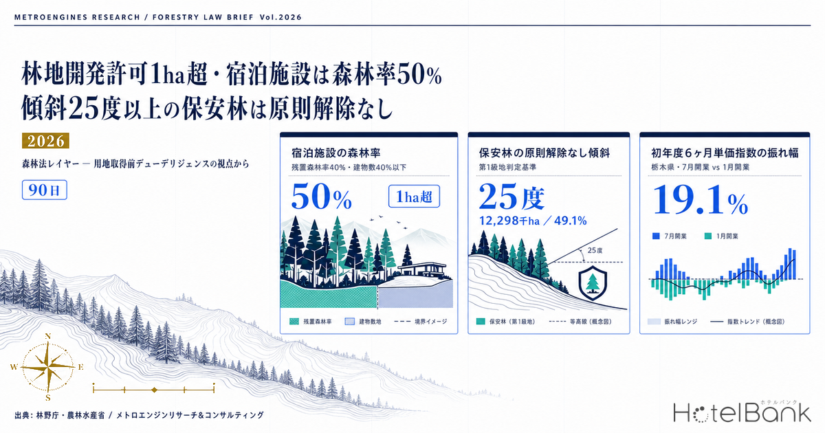
When you clear forest to build lodging, the first thing to check is neither the zoning district nor the floor-area ratio. It is whether the land counts as “forest” under the Forest Act. Carrying out a development act on more than one hectare of privately owned forest covered by a Regional Forest Plan requires a forest land development permit from the prefectural governor. For lodging and leisure facilities, the forest cover ratio inside the project area must be kept at roughly 50 percent or more, the building footprint held to 40 percent or less of the project area, and a forest belt roughly 30 metres wide retained along the perimeter. And if that forest is a protection forest, the question is no longer a permit but a de-designation — and slopes of 25 degrees or steeper are, as a rule, not released. This article organises the Forest Act permit layer from the standpoint of pre-acquisition due diligence, and quantifies how permit lead time feeds through to opening month and first-year rate levels, using monthly data from five mountain and resort prefectures.
How this differs from our earlier article. This article rests on a different legal source from “Japan Earthwork Permits Cover 81.8% of Land: Slope Resort Costs 2026”. The Embankment Regulation Act (the Act on Regulation of Residential Land Development and Specified Embankments) regulates “moving earth” inside designated regulated areas, and its permit criteria concentrate on retaining walls, drainage and ground stability. The Forest Act covered here regulates the act of “converting forest into non-forest” itself, and the permitting authority, the permit criteria and the review items are all different. Because the two can apply to the same project at once, organising that overlap into a single table is the central aim of this article. For the zoning-division and farmland-conversion side, see “61% of 2026 Hotel Openings Fall Outside Urbanization Promotion Areas”.
Metric Definitions Used in This Article
- ADR (average daily rate) = an estimated settled rate (tax-excluded equivalent), calculated by applying a category-specific adjustment coefficient to the cheapest plan level each property publishes on OTAs (double occupancy, per-room rate, tax included). Cross-checked against property-level disclosures by listed hotel REITs (91 properties, most recent three months), the median error is approximately 7%. These are estimates and differ from each property’s actual transacted prices and accounting figures. Area-level ADR is the median across the target properties (the level of a typical property in the area).
- First-six-month rate index = the sum of market rate levels a property opening in a given month faces over its first six months, built up from that area’s monthly estimated settled ADR for resort-category properties (2025 actuals). Occupancy and room count are not considered; the metric isolates the seasonal placement of market rates alone.
- Retained forest ratio / forest cover ratio = as defined in Appendix 4 of the Forestry Agency notice “On the Application of Permit Criteria for Development Acts” (15 November 2022, No. 1188). The retained forest ratio is the area of retained forest excluding young stands (15 years old or under), as a share of the forest area inside the project area. The forest cover ratio is the combined area of retained forest and newly created forest as a share of the same.
- Data sources = lodging rates and property counts from MetroEngines Research & Consulting. Legal framework and area statistics from the Forestry Agency, the Ministry of Agriculture, Forestry and Fisheries, the Ministry of Land, Infrastructure, Transport and Tourism, and published prefectural materials.
- — A forest land development permit is triggered above one hectare (0.5 hectare for solar). The area counted is not the building footprint but the “area where the form or quality of land is altered,” including cut-and-fill slopes, construction roads and retention ponds.
- — Lodging facilities face 50 percent forest cover, a building footprint of 40 percent or less, and a 30-metre perimeter belt. Below roughly 2.67 hectares, the 30-metre perimeter belt binds harder than the building-footprint cap.
- — For protection forest, a slope of 25 degrees or steeper is one of the Class 1 land tests, and Class 1 land is as a rule not released. That collides head-on with the instinct to chase slopes for the view.
- — The 90-day standard processing period excludes time spent on corrections, consultations with other authorities and referral to the Prefectural Forest Council. The date construction can start moves in units of six months to a year.
- — Permit delay bites hardest at six months: in Tochigi, the market rate base over the first six months after opening falls 16.0 percent. A 12-month slip returns the seasonal placement to where it started.
Conclusion — the Forest Act decides not “can you build” but “when can you start” and “how much must you keep”
Start with the conclusion. First, the Forest Act permit layer applies regardless of whether the site sits inside or outside a city planning area. Even on a mountain resort site with no zoning district and no floor-area ratio, if the land is privately owned forest covered by a Regional Forest Plan and the forest area subject to the development act exceeds one hectare, a forest land development permit from the prefectural governor is required (Forest Act, Article 10-2). Where the purpose is a solar power facility, the threshold has been 0.5 hectare since 1 April 2023, leaving a gap between solar and non-solar projects.
Second, the permit works through “layout,” not “yes or no.” The Forestry Agency’s operational notice sets, by development purpose, the share of forest that must be secured inside the project area. For lodging and leisure facilities, that means a forest cover ratio of roughly 50 percent or more (retained forest ratio roughly 40 percent), a building footprint of roughly 40 percent or less of the project area, and, as a rule, a belt of retained or newly created forest roughly 30 metres or more wide along the perimeter. Overlay those three geometrically and a structure appears: the smaller the project area, the lower the share of it that can be used effectively. On our estimate, assuming a square site, once the area falls below roughly 2.67 hectares the 30-metre perimeter belt becomes a harder constraint than the 40 percent building-footprint cap.
Third, protection forest changes the question. Protection forest sits outside the forest land development permit regime — not because regulation is lighter, but because nothing can be developed there unless the designation is first released. In screening a release for conversion, the protection forest concerned is sorted into Class 1 and Class 2 land, with slopes of 25 degrees or steeper among the tests for Class 1. For Class 1 land, release is as a rule not granted, except where the manner and scale of the conversion are judged not to impair national land conservation. That criterion collides head-on with the resort-development instinct of chasing slopes for the view.
Fourth, what really bites is time. The standard processing period for a forest land development permit is set, in Oita Prefecture’s example, at 90 days for document review and related steps. But those 90 days exclude correction periods, time taken by other procedures (river consultations and the like), consultation periods with municipalities, and the interval between referral to the Prefectural Forest Council and its response. Projects with a development area of 10 hectares or more, or a protection-forest release covering one hectare or more, become referral cases. Add pre-application consultation, local notification and river consultations, and the date construction can start easily moves in units of six months to a year. Meanwhile, lodging rates in mountain and resort locations swing by roughly 1.5x across the year. What the multiplication of those two does to a first-year revenue ramp is the subject of the data half of this article.
Forest splits into three layers — Regional Forest Plan private forest, protection forest, and national forest
To read the Forest Act’s restrictions, you first have to split the forest in question into three layers. The forest land development permit applies to “privately owned forest covered by a Regional Forest Plan,” and excludes forest inside protection forests, erosion-control facility districts and coastal conservation areas. They are excluded not because regulation does not reach them, but because a stronger, separate regime already does.
| Layer | Legal basis and procedure | Authority | What it means in practice |
|---|---|---|---|
| Private forest under a Regional Forest Plan | Forest Act, Article 10-2 Forest land development permit | Prefectural governor | The main battleground of this article. A permit is required once the area exceeds 1 ha (0.5 ha for solar). The permit criteria are four tests — disaster prevention, flood prevention, water supply and environmental conservation — and the structure is binding: where none of them applies, the governor must grant the permit. |
| Protection forest | Forest Act, Articles 25 and 26 Release of designation | Minister of Agriculture, Forestry and Fisheries, or prefectural governor (varies by protection forest type and watershed) | Outside the forest land development permit regime. Development presupposes release of the designation. Releases for conversion are screened by Class 1 / Class 2 land, and Class 1 land is as a rule not released. Nationwide, protection forest covers 12,298 thousand ha in actual area — 49.1% of forest area and 32.5% of national land area (as of 31 March 2025). |
| National forest | Act on the Administration and Management of National Forest Lease and use permits | Regional Forest Office / District Forest Office | Not the forest land development permit framework but the world of contracts and use permits with the state. Before assessing project viability at all, you have to confirm with the District Forest Office whether the land can even be leased. |
Source: Compiled by MetroEngines Research & Consulting from the Forestry Agency’s “Forest Land Development Permit System” and “Protection Forest Area,” and the Ministry of Agriculture, Forestry and Fisheries’ “Guidelines on the Handling of Releases for Protection Forest Conversion”
Within protection forest, water-source conservation forest accounts for 9,280 thousand ha, sediment-outflow prevention forest for 2,629 thousand ha and landslide prevention forest for 61 thousand ha (actual area, as of 31 March 2025). Water-source conservation forest is large in area, so the probability of encountering it on a mountain site is high. Moreover, water-source conservation, sediment-outflow prevention and landslide prevention forests within privately owned forest in important watersheds include those designated by the Minister of Agriculture, Forestry and Fisheries, which changes the application route for release. If even a sliver of the site is protection forest, the scheduling assumptions have to be rebuilt.
How to count one hectare — the “area where the form or quality of land is altered,” including slopes, construction roads and retention ponds
The most common error in practice is not the threshold itself but how the area is counted. Oita Prefecture’s guidance states explicitly that, for new or reconstructed roads, the count “includes not only the road surface area but also the area where the form or quality of land is actually altered, such as cut-and-fill slopes.” Slopes created by earthworks, construction roads, retention ponds, car parks and spoil-storage areas are all counted. Projects that sit under one hectare on building footprint alone but cross the threshold the moment access roads and earthwork slopes are added are not unusual.
A second trap is the “unity of a development act.” The Forestry Agency’s operational notice sets out three tests for judging unity. First, unity of the implementing party: where the projects can be seen as involving the same operator, judged from capital and employment ties, the post-completion operator or facility manager, or coordinated planning by the same forest owner. Second, unity of timing: where the timing overlaps or runs consecutively in a way that reads as a single planned sequence. Third, unity of location: where construction roads, drainage facilities or similar infrastructure are shared, or where the drainage system is common within a localised catchment.
What this means for multi-site operators. Where glamping or villa units are developed in phases across several parcels in the same area, keeping each parcel to 0.9 hectare will not help if the access road or drainage system is shared — the whole thing can be treated as a single development act. In practice, rather than designing around the threshold by splitting applications, planning from the outset as a single project of more than one hectare and optimising the layout of retained forest makes the schedule far easier to read.
On top of this sit prefectural ordinances. Chiba Prefecture, under its Ordinance on the Proper Conduct of Forest Land Development and Related Acts, requires notification to the governor for small-scale forest land development of 0.3 hectare or more and up to one hectare (0.3 hectare or more and up to 0.5 hectare for solar power facilities). Judging a project “out of scope” by looking only at the Forest Act’s one-hectare threshold means missing the ordinance notification. The presence of ordinances and guidelines must be checked individually for the prefecture where the site sits.
The four review tests, and the numbers that drive design — 50% forest cover, 40% footprint, 30m perimeter
The review criteria for a forest land development permit are the inverse of the four grounds for refusal in Article 10-2, paragraph 2 of the Forest Act: (1) risk of causing sediment outflow, collapse or other disasters (disaster prevention); (2) risk of causing flooding in areas dependent on that function (flood prevention); (3) risk of materially impairing the water supply in areas dependent on that function (water-source conservation); and (4) risk of materially degrading the environment in the area surrounding that forest (environmental conservation). Where the governor finds that none of these applies, the permit must be granted.
What bears most directly on resort design is the fourth test, environmental conservation, given concrete form as the share of forest to be retained or created inside the project area. Appendix 4 of the Forestry Agency notice sets this out by development purpose as follows.
| Purpose of the development act | Share of forest to be retained or created | Forest layout (principal items) |
|---|---|---|
| Lodging and leisure facilities | Forest cover ratio roughly 50% (retained forest ratio roughly 40%) or more | A belt of retained or newly created forest roughly 30 m or more wide along the perimeter. Building footprint to be roughly 40% or less of the project area, and where multiple lodging buildings are placed, they are to be dispersed as far as possible. Leisure facility development acts are to be roughly 5 ha or less per location. |
| Second-home (villa) subdivisions | Retained forest ratio roughly 60% or more | A belt of retained or newly created forest roughly 30 m or more wide along the perimeter. Each lot to be roughly 1,000 m² or more, with building footprint and similar at roughly 30% or less. |
| Ski area development | Retained forest ratio roughly 60% or more | Run width roughly 50 m or less. Where multiple runs are placed side by side, retained forest roughly 100 m or more wide in between. Slopes and similar roughly 5 ha or less per location. Cut volume for run construction roughly 1,000 m³ or less per hectare. |
| Golf course development | Forest cover ratio roughly 50% (retained forest ratio roughly 40%) or more | A belt of retained or newly created forest roughly 30 m or more wide along the perimeter and between holes. Cut and fill volumes each roughly 2 million m³ or less per 18 holes. |
| Factories and business premises | Forest cover ratio roughly 25% or more | Where forest area is 20 ha or more, a perimeter belt roughly 30 m or more wide. Roughly 20 ha or less per location. For factories and business premises, the requirement is not to fall below 20%. |
| Residential subdivisions | Forest cover ratio roughly 20% or more (including green space) | Where forest area is 20 ha or more, a perimeter belt roughly 30 m or more wide of retained forest, created forest or green space. |
Source: Compiled by MetroEngines Research & Consulting from Appendix 4 of the Forestry Agency’s “On the Application of Permit Criteria for Development Acts” (15 November 2022, Ringeiji Notice No. 1188). Per that notice’s own annotation, “roughly” indicates a tolerance of 20 percent.
Under the notice, “lodging facilities” are defined as facilities used exclusively for accommodation — hotels, ryokan, minshuku, pensions, corporate retreats and the like — together with their ancillary facilities, and buildings with multiple owners such as resort condominiums are also treated as falling within this category. “Villa land,” by contrast, refers to land on which dwellings and similar structures for non-routine purposes such as recreation are to be established as a group. Whether villas are sold off or retained and rented out splits the applicable retained forest ratio between 60 percent and 40 percent. The design of the business scheme feeds directly into which permit standard applies.
Estimate assumptions: the project area is assumed square, with a 30 m belt of retained or newly created forest along the perimeter; the chart shows the resulting interior share. The building footprint cap is 40% of the project area (lodging and leisure facilities). Because newly created forest cannot be built on either, the interior area functions as the effective ceiling. Source: Estimated by MetroEngines Research & Consulting based on Appendix 4 of the Forestry Agency’s “On the Application of Permit Criteria for Development Acts”
What the estimate above shows is the non-linear relationship between site scale and regulatory burden. Because the 30-metre perimeter belt has a fixed width, its share of the area jumps as the site shrinks. On a one-hectare project area (100 metres square), only 1,600 square metres remain inside — 16.0 percent of the site. At 1.5 hectares it is 26.0 percent, at 2 hectares 33.1 percent, and at roughly 2.67 hectares (163 metres square) it finally reaches 40 percent, crossing the 40 percent building-footprint cap. Above that scale the footprint cap binds first: at 5 hectares the interior share is 53.5 percent, at 10 hectares 65.7 percent, and the geometric constraint loosens.
This structure means that development on a site just over one hectare is the most disadvantaged. A project that crosses the permit threshold by a hair carries the permit cost and the schedule while its usable share of area is close to the minimum. In practice the judgment tends to fall one way or the other: keep the site at one hectare or below and stay outside the permit regime (checking ordinance notification requirements separately), or plan at three hectares or more and dissolve the geometric penalty. Projects in the middle band demand the most careful examination at the business-plan stage.
The disaster and flood prevention tests also bite on design in numbers. Cutting is in principle to be stepped, and where the cut height of earth exceeds 10 metres, benches are as a rule to be placed every 5 to 10 metres. Where fill height exceeds 5 metres, benches are likewise as a rule placed every 5 metres. Where a cut slope is steeper than 30 degrees and more than 2 metres high — or, for fill, steeper than 30 degrees and more than 1 metre high — whether a retaining wall or similar is required is judged according to soil conditions. For flood regulation, the storage volume must, taking downstream discharge capacity into account, be able to hold peak flow during and after development to no more than the pre-development peak flow at the rainfall intensity assumed on a 30-year return period, and the method is in principle natural discharge. Whether there is room for a retention pond on sloping ground is decided by the shape of the site itself.
Protection forest — work backwards from the premise that 25 degrees or steeper is not released
To develop forest designated as protection forest, release of the designation is a precondition. There are two routes to release: release because the reason for designation has ceased to exist (Forest Act, Article 26, paragraph 1), and release for reasons of public interest (paragraph 2 of the same article). Where the purpose is conversion, the Ministry of Agriculture, Forestry and Fisheries’ “Guidelines on the Handling of Releases for Protection Forest Conversion” set the review framework.
| Review item | Content under the guidelines |
|---|---|
| Land classification | The protection forest concerned is sorted into Class 1 and Class 2 land. The Class 1 tests include: a slope of 25 degrees or steeper (excluding cases where parts of 25 degrees or steeper are only locally present); proximity to facilities important to national life such as dwellings, school buildings, farmland and roads, with a direct and material bearing on conserving those facilities or maintaining their function; and terrain or geology prone to collapse. |
| Treatment of Class 1 land | Release is as a rule not granted, except where the manner and scale of the conversion are judged not to impair national land conservation. |
| Treatment of Class 2 land | Release is granted only where, taking into account the deployment of protection forest in the area and the purpose, manner and scale of the conversion, unavoidable circumstances are recognised and the achievement of the purpose of the protection forest designation is judged not to be impaired. |
| Site circumstances | Judged from the purpose of the conversion and land-use conditions in the area, it must be impossible or markedly difficult to find a suitable alternative site. |
| Area | The area must be the minimum necessary to realise the purpose of the conversion. |
| Certainty of realisation | The concreteness of the project plan, acquisition of land use rights, securing of related land, certainty of statutory approvals, and the operator’s creditworthiness, financial capacity and technical capability are all confirmed. |
| Consent of interested parties | The consent of the head of the municipality and of parties with a direct interest in the release must have been obtained. |
| Substitute facilities | Confirmation that measures such as installing substitute facilities have been, or will reliably be, taken so that achieving the purpose of the protection forest designation is not impaired. |
Source: Compiled by MetroEngines Research & Consulting from the Ministry of Agriculture, Forestry and Fisheries’ “Guidelines on the Handling of Releases for Protection Forest Conversion”
In practice, the first thing that bites is the 25-degree figure. Turning views and slopes into value is standard practice in resort development — but if that slope is protection forest at 25 degrees or steeper, it falls into Class 1 and is as a rule outside the scope of release. Unless slope is computed from elevation data and overlaid on the protection forest boundary at the site-selection stage, the project may simply not stand up after acquisition.
Next comes the order of procedure. Release proceeds by public notice. Written opinions may be submitted within 30 days of the notice under Article 30 or Article 30-2, paragraph 1 of the Forest Act, and where an opinion is submitted, a public hearing is held. Confirmation that substitute facilities have been installed is carried out after 40 days have elapsed from the date of the notice, and the release notice is to be issued only after that confirmation is complete. In other words, substitute facilities (erosion-control works and the like) must actually be built and their completion confirmed before the release becomes final. The design, costing and construction periods stack directly onto the schedule.
In addition, in Oita Prefecture’s example, releases for protection forest conversion covering one hectare or more — other than those where the project is undertaken by the state or a local authority — meet the criteria for referral to the Prefectural Forest Council. The interval from referral to response is excluded from the standard processing period. Projects that include one hectare or more of protection forest have their schedules subordinated to the council’s meeting cycle.
Overlap with the Embankment Regulation Act and the City Planning Act — one table
On sloping resort sites it is not unusual for the Forest Act, the Embankment Regulation Act and the City Planning Act to apply at once. Different legal sources mean different permitting authorities and different criteria, and a permit under one does not necessarily substitute for another. The table below sets them out in the order they are assessed in practice.
| Item | Forest Act (forest land development permit) | Embankment Regulation Act | City Planning Act (development permit) |
|---|---|---|---|
| Legal source | Forest Act, Article 10-2 | Act on Regulation of Residential Land Development and Specified Embankments | City Planning Act, Article 29 |
| Permitting authority | Prefectural governor | Prefectural governor and others | Prefectural governor and others |
| Acts covered | Development acts that convert forest to non-forest, or alter the form or quality of forest | Fill, cut and similar within regulated areas (acts that move earth) | Alteration of land division, form or quality for the purpose of building construction |
| Areas covered | Privately owned forest under a Regional Forest Plan (excluding forest within protection forests, erosion-control facility districts and coastal conservation areas) | Residential land development work regulated areas and specified embankment regulated areas (regardless of land use or whether inside a city planning area) | City planning areas, quasi-city planning areas, and areas outside them that meet the scale thresholds |
| Threshold | Forest area above 1 ha (solar power facilities above 0.5 ha; roads at 1 ha in area and 3 m in width) | Judged on the height of fill creating a cliff, the height of cut, and the developed area (varies by area type) | 1,000 m², 3,000 m², 1 ha and similar depending on the zoning division (varies by area) |
| Review focus | The four tests of disaster prevention, flood prevention, water supply and environmental conservation — plus the share and layout of retained and created forest | Safety of retaining walls, drainage facilities and ground; interim inspection during construction, completion inspection and periodic reporting | Technical standards (roads, drainage, water supply, parks and so on) and, outside such areas, the appropriateness of the development |
| Forest cover requirement | Yes (lodging: 50% forest cover, 30 m perimeter) | None | None (green space requirements arise from ordinances) |
| Substitution / deemed permits | Not substituted by permits under other laws. Independently required | Provisions deem the permit or notification satisfied where a development permit under Article 29 of the City Planning Act has been obtained (Articles 15, 27 and 34 of the same act) | — |
| Councils | Projects of 10 ha or more and similar are referred to the Prefectural Forest Council (referral-to-response time excluded from the standard processing period) | — | — |
| Standard processing period (example) | 90 days (Oita; corrections, other procedures, consultations and referral time excluded) | Varies by prefecture | Varies by prefecture |
Source: Compiled by MetroEngines Research & Consulting from the Forestry Agency’s “Forest Land Development Permit System,” Oita Prefecture’s “Guide to the Forest Land Development Permit System” (April 2024), and the Ministry of Land, Infrastructure, Transport and Tourism’s materials on the Act on Regulation of Residential Land Development and Specified Embankments
Two points stand out. First, while the Embankment Regulation Act has a deeming provision where a development permit under Article 29 of the City Planning Act has been obtained, the Forest Act’s forest land development permit has no such substitution relationship. Obtaining a development permit does not remove the need for the Forest Act permit, which is independently required. Second, in order of assessment, the Forest Act comes first. Whether land is forest, and whether it is protection forest, are attributes of the land, settled before the scale or content of the project plan. Pre-acquisition investigation is rationally organised in that order.
Permit lead time moves the opening month — monthly rates in five mountain resort prefectures swing up to 1.9x
From here the article turns quantitative. The impact of the Forest Act permit process on a project shows up as time rather than cost. The 90-day standard processing period is the actual review time; stack on pre-application consultation, local notification, drainage consultation with the river administrator, obtaining rights-holder consent (consent from two-thirds or more of those holding rights that would obstruct the development act is a requirement), and the Prefectural Forest Council’s meeting cycle, and the date construction can start easily slips by several months to a year. What matters here is that lodging revenue is not neutral to that slip.
Using MetroEngines Research & Consulting data, we look at monthly estimated settled ADR for resort-category properties across five mountain and resort prefectures over the twelve months of 2025.
Source: MetroEngines Research & Consulting (median monthly estimated settled ADR for resort hotel category. N = Nagano 111–135 properties, Yamanashi 55–60, Hokkaido 126–141, Shizuoka 128–135, Tochigi 37–41. Property counts vary by month)
| Prefecture | Peak month | Trough month | Peak ÷ trough | 2025 average | Jan–Jul 2026 average | N (properties) |
|---|---|---|---|---|---|---|
| Nagano | ¥20,636 (Aug) | ¥13,590 (Mar) | 1.52x | ¥16,268 | ¥16,251 | 111–135 |
| Yamanashi | ¥25,790 (Aug) | ¥16,678 (Feb) | 1.55x | ¥19,946 | ¥18,830 | 55–60 |
| Hokkaido | ¥20,667 (Aug) | ¥14,064 (Oct) | 1.47x | ¥16,887 | ¥16,674 | 126–141 |
| Shizuoka | ¥24,903 (Aug) | ¥15,754 (Jun) | 1.58x | ¥18,290 | ¥17,874 | 128–135 |
| Tochigi | ¥27,281 (Aug) | ¥14,290 (Jun) | 1.91x | ¥18,007 | ¥16,203 | 37–41 |
Source: MetroEngines Research & Consulting (median monthly estimated settled ADR for resort hotel category, actual months January 2025 – July 2026)
August is the peak month in all five prefectures, and the peak-to-trough ratio ranges from 1.47x in Hokkaido to 1.91x in Tochigi. Nagano is 1.52x (March ¥13,600 → August ¥20,600) and Shizuoka 1.58x (June ¥15,800 → August ¥24,900). Hokkaido alone has a narrow swing because it has a twin-peak structure — summer (July–August) and winter (January–February) — leaving a shallow annual trough, with January 2025 at ¥18,800 and February at ¥19,000 holding up through the winter. Nagano, conversely, also peaks in December and January (December 2025 ¥20,100, January 2026 ¥20,900), showing ski demand pushing rates up.
Method: for each prefecture, the monthly estimated settled ADR for the resort category (2025 actuals) summed over six months from the opening month. Occupancy, room count and ramp-up are not considered; the index isolates the seasonal placement of market rates alone. Source: MetroEngines Research & Consulting
| Prefecture | Best opening month | Worst opening month | Difference | Gap |
|---|---|---|---|---|
| Nagano | Aug ¥104,348 | Feb ¥90,868 | ¥13,480 | 14.8% |
| Shizuoka | Aug ¥115,787 | Feb ¥103,698 | ¥12,089 | 11.7% |
| Tochigi | Jul ¥117,460 | Jan ¥98,620 | ¥18,840 | 19.1% |
| Yamanashi | Jul ¥128,049 | Jan ¥111,299 | ¥16,750 | 15.0% |
| Hokkaido | Aug ¥103,664 | Feb ¥98,982 | ¥4,682 | 4.7% |
Source: MetroEngines Research & Consulting (estimated from estimated settled ADR for the resort hotel category, actual months of 2025)
In Nagano, the total market rate faced over the first six months differs by 14.8 percent between an August opening and a February one. Shizuoka is 11.7 percent, Tochigi as much as 19.1 percent (July versus January opening), Yamanashi 15.0 percent and Hokkaido 4.7 percent. These figures consider neither occupancy nor room count — they isolate the seasonal placement of market rates alone. Even so, they indicate the range across which the first-half rate base moves when a permit process slips six months and a summer opening becomes a midwinter one. Because actual rates immediately after opening carry a further ramp-up lag (on rate formation at newly opened properties, see “New Hotel ADR Ramp-Up: 91 Japan Openings Split Into 4 Pricing Types”), the seasonal placement of the opening month is not a variable lenders can ignore when looking at first-year debt service coverage.
For reference, here is the level posted by a listed resort REIT. Hoshino Resorts REIT (星野リゾート・リート投資法人) reported monthly operating results for June 2026 of 74.2 percent occupancy, ADR ¥18,478 and RevPAR ¥13,716 across the whole portfolio, with RevPAR down 6.4 percent year on year. The estimated settled ADR in this article (2025 average of ¥16,300 for the Nagano resort category, ¥19,900 for Yamanashi) sits broadly in the same range as the disclosed level for a resort REIT. That said, the figures here are estimates, and the median error against REIT disclosures is approximately 7 percent — worth noting.
Source: MetroEngines Research & Consulting (based on confirmed OTA listings, N = 1,741 properties)
Source: MetroEngines Research & Consulting (based on confirmed OTA listings, N = 1,741 properties)
Of the 1,741 properties confirmed as opening in 2025, the largest count is April with 246, followed by July with 214 and December with 167 — those three months accounting for 36.0 percent. By category, vacation rental villas stand out at 747 (42.9 percent), followed by cottages at 113, glamping at 22, campsites at 16 and lodges at 14. Small, dispersed supply premised on forest and natural settings sits at the centre of new openings. On the distribution of opening months itself, “Japan Hotel Openings: April, July, December Peaks, 2.70x Gap” covers three years of data.
Overlay the Forest Act perspective and two implications emerge. First, categories such as vacation rental villas, cottages and glamping have a small footprint per unit and often fall short of the one-hectare threshold on their own. That is precisely why the “unity” judgment becomes the watershed when rolling out multiple sites. Second, because these categories presume dispersed layouts, they sit comfortably with a design that scatters buildings within retained forest. That the lodging standard requires multiple lodging buildings to be “dispersed as far as possible” is a constraint on small, dispersed resort supply — and at the same time means the design direction already aligns with the regulation.
Note: new-opening data is based on confirmed OTA listings. Because listings appear several months before opening, counts for recent and later months may rise as further listings are confirmed. As 2025 is a completed calendar year, this effect is limited here.
Lodging supply in the eight major mountain resort areas where the Forest Act layer bites
Where the Forest Act permit layer actually bites is in mountain and highland locations with high forest cover. Nationwide forest area is 25,048,199 hectares and the forest cover ratio is 67 percent (as of 31 March 2017), but in mountain prefectures it reaches around 80 percent — Nagano 79 percent, Gifu 81 percent, Kochi 84 percent. The map below shows registered lodging property counts and room counts within a 5-kilometre radius for eight major mountain and highland resort areas.
Source: MetroEngines Research & Consulting (based on property master registrations, including properties that have ceased operating)
| Area | Properties | Rooms | 20+ rooms |
|---|---|---|---|
| Hakuba & Otari Nagano | 1,045 | 9,513 | 92 |
| Northern Fuji & Lake Kawaguchi Yamanashi | 608 | 7,632 | 93 |
| Izu Kogen Shizuoka | 610 | 4,507 | 31 |
| Karuizawa Nagano | 204 | 4,243 | 47 |
| Tateshina & West Yatsugatake Nagano | 264 | 3,785 | 33 |
| Hakone Kanagawa | 173 | 3,130 | 40 |
| Niseko & Kutchan Hokkaido | 129 | 1,465 | 10 |
| Nasu Kogen Tochigi | 123 | 1,126 | 13 |
Source: MetroEngines Research & Consulting (5 km radius from each area centre point, based on property master registrations)
Hakuba and Otari stand out with 1,045 properties and 9,513 rooms, yet only 92 of those properties have 20 rooms or more. Northern Fuji and Lake Kawaguchi has 608 properties and 7,632 rooms with 93 at 20-plus rooms; Izu Kogen has 610 properties and 4,507 rooms with 31 at 20-plus. Supply in these areas is therefore two-tiered: a small number of mid-to-large properties and an overwhelming majority of small ones. Much of the small tier works on sites under one hectare, staying outside the forest land development permit regime or going no further than ordinance notification. Try to build a new mid-to-large property of 20 rooms or more, however, and the project area — car park, approach road and retention pond included — easily exceeds one hectare, at which point you are in forest land development permit territory. The difficulty of climbing one step up the size ladder within these areas stems not only from competitive conditions but from this permit layer. On Niseko and Kutchan’s supply structure see “Niseko’s Top Tier: Just 2 Hotels, 75 Rooms — Where Fairmont’s 165 Fit”, and on room distribution around ski areas see “Japan’s 30 Ski Resorts: 40,419 Rooms Within 3km, Top 3 Hold 39%”.
Pre-acquisition due diligence — a Forest Act checklist
The following are the Forest Act items to confirm before deciding to acquire a site, ordered from those with the highest cost of reversal.
| # | Item to confirm | Where to confirm | What decides it |
|---|---|---|---|
| 1 | Is it protection forest (type and designation date)? | Protection forest register held by the prefectural erosion-control division; protection forest GIS and published maps | If yes, you are in the world of de-designation, not the development permit. This changes the premise of project viability, so check it first. |
| 2 | If protection forest, are there parts at 25 degrees or steeper? | Slope analysis from a digital elevation model, overlaid on the protection forest boundary map | 25 degrees or steeper (other than locally present parts) is one of the Class 1 land tests. Class 1 land is as a rule not released. |
| 3 | Is it private forest under a Regional Forest Plan? | Forest register and forest plan maps held by the prefectural forestry division | Land can be covered even if its registered category is not woodland. Conversely, if it is not covered, no forest land development permit is needed. Confirm from the forest plan map, not the registered land category. |
| 4 | Does the site include national forest? | Registry information plus the District Forest Office with jurisdiction | National forest sits outside the forest land development permit framework, in lease and use-permit procedures under the Act on the Administration and Management of National Forest. |
| 5 | Does the forest area subject to the development act exceed 1 ha (0.5 ha for solar)? | Earthworks plan drawings (including slopes, construction roads, retention ponds, car parks and spoil storage) | Judged on the “area where the form or quality of land is altered,” not the building footprint. Omitting slopes produces an understatement. |
| 6 | Could it be judged a single development act with other plans or parcels? | Your own and affiliates’ nearby plans; shared construction road and drainage system plans | Judged on three tests: implementing party, timing and location. Shared drainage is the classic case of unity of location. |
| 7 | Are there additional prefectural ordinance or guideline requirements? | Prefectural forestry division; lists of ordinances and guidelines | Chiba requires notification to the governor at 0.3 ha and above up to 1 ha (0.3 ha to 0.5 ha for solar). Do not judge on the 1 ha threshold alone. |
| 8 | Likelihood of rights-holder consent | Registry information; superficies, leasehold and common-use rights | Consent from two-thirds or more of those holding rights that would obstruct the development act is an application requirement. On jointly owned or common-use forest, the difficulty rises sharply. |
| 9 | Discharge point and downstream capacity | River administrator; downstream water rights holders; catchment maps | Can peak flow during and after development be held to no more than the pre-development level at the rainfall intensity assumed on a 30-year return period? Room for a retention pond is decided by site shape. |
| 10 | Does the retained forest layout work? | A verification drawing overlaying the 30 m perimeter belt and the 40% footprint cap on the site plan | Lodging requires 50% forest cover, 40% retained forest and a footprint of 40% or less. Below roughly 2.67 ha the 30 m belt binds harder. |
| 11 | Will it be referred to the Prefectural Forest Council? | The prefecture’s referral criteria | Development area of 10 ha or more, protection forest release of 1 ha or more, and similar. Referral-to-response time is excluded from the standard processing period. Build the council’s meeting cycle into the schedule. |
| 12 | Overlap with the Embankment Regulation Act and City Planning Act | Regulated area maps; city planning maps | A development permit does not remove the independently required forest land development permit. The Embankment Regulation Act does have a deeming provision for development permits. |
| 13 | Time to completion confirmation | The prefecture’s practice | Where vegetation is not expected to establish, greening measures are preferably assessed on vegetation cover one year after the works, with completion confirmed after at least one further year of monitoring. |
Source: Compiled by MetroEngines Research & Consulting from the Forestry Agency’s “Forest Land Development Permit System” and “On the Application of Permit Criteria for Development Acts,” the Ministry of Agriculture, Forestry and Fisheries’ “Guidelines on the Handling of Releases for Protection Forest Conversion,” Oita Prefecture’s “Guide to the Forest Land Development Permit System” (April 2024) and Chiba Prefecture’s “Guide to Small-Scale Forest Land Development”
For land acquisition teams
The order to confirm before acquiring is: protection forest status → slope → forest plan map. All three are settled as attributes of the land, ahead of the project plan, and can be judged before price negotiation. Discovered after acquisition, they cannot be undone.
For multi-site operators
Avoiding the threshold by splitting parcels can be overturned by the unity tests of implementing party, timing and location. If construction roads and drainage are shared, designing as one project from the start makes the schedule readable. Above roughly 2.67 ha the geometric penalty also dissolves.
For lenders and asset managers
Beyond the 90-day standard processing period, council referral, substitute facility works and completion confirmation stack onto the schedule. If the opening month slips six months, the first-six-month market rate base moves 14.8% in Nagano. In collateral assessment it is reasonable to treat schedule risk differently depending on whether the permit is already in hand.
How many months of delay is worst — a two-axis sensitivity of delay months by prefecture
Up to here we have looked at “what happens if the opening month differs.” What land teams and lenders actually face is the question one step earlier: how many months will the permit be delayed? So, taking as the planned baseline the month in which the six-month post-opening market rate total is highest in each prefecture, we set out the rate of change if the permit delay pushes the opening back by 3, 6, 9 and 12 months. Occupancy, room count and ramp-up are not considered; this is an index isolating the seasonal placement of market rates alone.
| Prefecture | Baseline month | +3 months | +6 months | +9 months | +12 months |
|---|---|---|---|---|---|
| Nagano | Aug | -9.0% | -12.9% | -3.9% | +0.0% |
| Yamanashi | Jul | -11.8% | -13.1% | -1.3% | +0.0% |
| Hokkaido | Aug | -2.2% | -4.5% | -2.3% | +0.0% |
| Shizuoka | Aug | -5.8% | -10.4% | -4.7% | +0.0% |
| Tochigi | Jul | -11.3% | -16.0% | -4.7% | +0.0% |
Source: MetroEngines Research & Consulting (estimated from estimated settled ADR for the resort hotel category, actual months of 2025. N = Nagano 111–135 properties, Yamanashi 55–60, Hokkaido 126–141, Shizuoka 128–135, Tochigi 37–41)
Three things read out of this. First, the impact of delay is not proportional to its length. The worst case is a six-month delay: down 16.0 percent in Tochigi, 13.1 percent in Yamanashi and 12.9 percent in Nagano. A peak-season opening shifts straight into a shoulder-season one. Second, a 12-month delay is neutral in seasonal terms. Slipping a full year returns you to the same month, so accepting delay in one-year units can, on rate placement alone, be more favourable than stopping at six months. Third, the size of the effect varies more than threefold by location. Hokkaido is at worst 4.5 percent, against 16.0 percent in Tochigi. In markets with modest seasonality, the weight to place on permit lead-time delay as a schedule risk changes.
For lenders and asset managers. On deals where the site is acquired before the Forest Act permit is in hand, a three-month delay and a six-month delay need to be viewed separately. Measured on the first-half rate base, the deterioration bottoms out at six months, and a slip beyond that to a full year actually recovers. Discounting schedule risk at a flat rate per month loses this non-linearity.
Three scenarios to the construction start date — optimistic, central, pessimistic
So how many months should be allowed for the permit process? The 90-day standard processing period is the actual review time, not the period to the date construction can start. The following is our own estimate, built up from the procedural elements set out in published materials. The assumptions are stated in the “Estimate assumptions” note at the end of this article.
| Process element | Optimistic | Central | Pessimistic | What differs |
|---|---|---|---|---|
| Pre-application consultation and site survey | 2 months | 3 months | 4 months | Presence of protection or national forest; complexity of rights |
| Application documents and rights-holder consent | 3 months | 4 months | 5 months | Earthworks plan and drainage calculations; difficulty of securing two-thirds consent |
| Review (standard processing period) | 3 months | 3 months | 3 months | 90 days in Oita’s example. Varies by prefecture |
| Responding to corrections | 0.5 month | 1.5 months | 2 months | Excluded from the standard processing period |
| Municipal consultation and other procedures | — | 1 month | 1 month | River consultation and similar. Excluded from the standard processing period |
| Referral to the Prefectural Forest Council | — | — | 2 months | Development area of 10 ha or more and similar. Time to response excluded |
| Procedures for protection forest release | — | — | 3 months | Substitute facility confirmation after 40 days from notice; 30 days for written opinions |
| Indicative time to construction start | approx. 8.5 months | approx. 12.5 months | approx. 20 months | Optimistic = no protection forest, no council referral / Pessimistic = over 10 ha or involving protection forest release |
Source: Estimate built up by MetroEngines Research & Consulting from procedural elements set out in the Forestry Agency’s “Forest Land Development Permit System,” Oita Prefecture’s “Guide to the Forest Land Development Permit System” (April 2024) and the Ministry of Agriculture, Forestry and Fisheries’ “Guidelines on the Handling of Releases for Protection Forest Conversion.” Actual periods vary with each prefecture’s practice and the content of the project
The gap between the central and pessimistic scenarios is about 7.5 months — a span that straddles the six-month delay identified above as the worst zone in the sensitivity table. If protection forest status and council-referral applicability are settled at the point of the acquisition decision, those 7.5 months can be priced in beforehand. Discovered after acquisition, they move not only the schedule but the first-year rate base at the same time. That is where the value of clearing the Forest Act layer first in due diligence lies.
Summary — being forest bites the schedule, not the price
The Forest Act permit layer does not, like zoning districts and floor-area ratios, directly decide what and how much can be built. What it decides is how much of the project area must be left as forest, and when construction can start. The three numbers required for lodging and leisure facilities — forest cover of roughly 50 percent, a building footprint of roughly 40 percent or less, and a perimeter forest belt of roughly 30 metres — bite geometrically harder the smaller the site, and at around 2.67 hectares the binding constraint changes hands.
For protection forest, the Class 1 land test of a slope of 25 degrees or steeper cuts directly across the slope locations resort development seeks. That determination cannot be shifted by effort after acquisition, which makes it a point to clear early in site selection. And the procedural structure — release becomes final only after installation of substitute facilities is confirmed — stacks straight onto the schedule.
The value of time is especially large in mountain and resort locations. On 2025 actuals, the peak-to-trough ratio of monthly estimated settled ADR for the resort category reaches 1.52x in Nagano, 1.58x in Shizuoka and 1.91x in Tochigi. If the permit process slips six months and the opening month moves, the market rate base faced in the first half of year one changes by 14.8 percent in Nagano. The seasonal placement of the opening month moves first-year figures more than differences in earthwork cost do. The value of clearing the Forest Act layer in pre-acquisition due diligence lies not in judging whether the permit will be granted, but in being able to write when it will be granted into the business plan.
Related reading
- Japan Earthwork Permits Cover 81.8% of Land: Slope Resort Costs 2026
- 61% of 2026 Hotel Openings Fall Outside Urbanization Promotion Areas
- Japan Hotel Openings: April, July, December Peaks, 2.70x Gap
- New Hotel ADR Ramp-Up: 91 Japan Openings Split Into 4 Pricing Types
- Hotel Construction Cost ¥20.67M/Room: 35.0m² Floor Area in 31 Plans
References and sources
■ Data sources
Descriptions of the legal framework and procedures rest on published primary materials from the Forestry Agency, the Ministry of Agriculture, Forestry and Fisheries, the Ministry of Land, Infrastructure, Transport and Tourism and the prefectures. Rate data uses MetroEngines Research & Consulting’s monthly estimated settled ADR for the resort hotel category (January 2025 – July 2026, N = 37–141 properties by prefecture); supply-side data uses new-opening property data (2025, N = 1,741 properties) and the property master for the 5 km radius of eight major mountain resort areas.
■ Estimate assumptions
The geometric constraint on retained forest (roughly 2.67 hectares) is calculated as the point at which the interior area, after deducting a 30-metre perimeter forest belt from a project area assumed to be square, equals 40 percent of the site area. The opening-month rate index is the simple sum of monthly estimated settled ADR over six months from the opening month, and does not consider occupancy, room count or post-opening ramp-up. The three scenarios to the construction start date are our own estimate, built up from procedural elements set out in published materials (pre-application consultation, preparation of application documents, the 90-day standard processing period, corrections, consultations, referral to the Prefectural Forest Council and protection forest release procedures); they are not statutory periods.
■ Limitations and caveats
Estimated settled ADR is an estimate, and the median error against property-level disclosures by listed REITs is approximately 7 percent. Standard processing periods, referral criteria and ordinance-based additions differ by prefecture, and the practices of Oita, Chiba and others cited here cannot be applied as-is to other prefectures. The figures for forest cover, building footprint and perimeter belt are the levels set as “roughly” in the operational notice, and may be adjusted at the prefecture’s discretion in individual cases. This article is general information, not legal advice on any specific project.
■ Market data
- MetroEngines Research & Consulting — monthly estimated settled ADR for the resort category (Nagano, Yamanashi, Hokkaido, Shizuoka and Tochigi, January 2025 – July 2026); new-opening property data (based on confirmed OTA listings, 2025, N = 1,741 properties); property master (5 km radius of eight major mountain resort areas)
■ Forest Act and protection forest (primary sources)
- Forestry Agency, “Forest Land Development Permit System”
- Forestry Agency, “On the Application of Permit Criteria for Development Acts” (15 November 2022, Ringeiji Notice No. 1188)
- Forestry Agency, “Protection Forest Area” (as of 31 March 2025)
- Ministry of Agriculture, Forestry and Fisheries, “Guidelines on the Handling of Releases for Protection Forest Conversion”
- Forestry Agency, “On Administrative Procedures for Release of Protection Forest Designation” (30 June 2021, Ringeiji Notice No. 478)
- Forestry Agency, “On the Review of the Forest Land Development Permit System”
- Forestry Agency, “Forest Area and Forest Cover Ratio by Prefecture” (as of 31 March 2017)
■ Prefectural practice materials
- Oita Prefecture, Forest Conservation Division, “Guide to the Forest Land Development Permit System” (April 2024) — 90-day standard processing period, Forest Council referral criteria
- Chiba Prefecture, “Guide to Small-Scale Forest Land Development” — notification regime for over 0.3 ha and up to 1 ha
- Shizuoka Prefecture, “Forest Land Development Permit System”
- Aichi Prefecture, “About the Forest Land Development Permit System”
- Nagano Prefecture, Forestry Department, “Guide to Forest Land Development Permit Applications under the Forest Act” (April 2024)
- Hyogo Prefecture, Erosion Control Division, “Manual for Protection Forest Designation and Release Procedures” (April 2025)
■ Related legislation
■ REIT