

A “disaster hazard zone” (災害危険区域, saigai kiken kuiki) under Article 39 of Japan’s Building Standards Act is not a projection of the kind shown on a hazard map. It is an enforceable regulatory layer: a local government designates the zone by ordinance, and inside it construction itself can be restricted. For anyone sourcing a site, it is the layer that ultimately decides not the land price, the zoning or the floor-area ratio, but whether anything can be built at all.
What matters for hospitality use is that the statute explicitly names “buildings used as dwellings” (住居の用に供する建築物). On land where housing cannot be built, can a hotel be built? We scanned the disaster hazard zone data published by the Ministry of Land, Infrastructure, Transport and Tourism (MLIT) nationwide and checked the original text of eight ordinances.
Metric Definitions Used in This Article
- Disaster hazard zone: A zone designated by a local government by ordinance under Article 39(1) of the Building Standards Act. Under Article 39(2), the ordinance may prohibit the construction of buildings used as dwellings or impose other building restrictions. It is a different system from zones that show projected hazards, such as flood inundation zones or sediment disaster warning zones: inside a disaster hazard zone, the ordinance’s building restrictions actually apply.
- ADR (Average Daily Rate): An estimated realized rate (tax-exclusive equivalent) calculated by applying segment-specific adjustment factors to the lowest-plan price level each property publishes on OTAs and similar channels (per room, based on two guests, tax-inclusive). Reconciled against property-level results disclosed by listed hotel REITs (91 properties, most recent 3 months), the median error is about 7%. These are estimates and differ from each property’s actual realized prices and accounting figures. Area-level ADR is the median of the properties covered (the level of a typical property in the area).
- Official land price: Land price survey points (official land price publication and prefectural land price survey, 2025) from the MLIT Real Estate Information Library. Price per ㎡.
- Data sources: MLIT Real Estate Information Library / original ordinance texts and ordinance databases of each local government / MetroEngines Research & Consulting
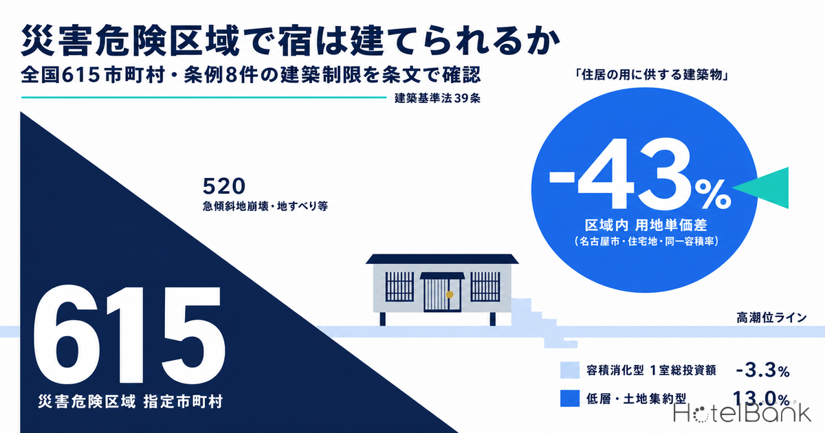
- — Disaster hazard zones were confirmed in 615 municipalities across 36 prefectures (122 ordinances). Of these, 520 municipalities are steep-slope/landslide designations; tsunami-type designations number only 30 (retrieved September 16, 2026, within scan range).
- — Treatment of lodging use differs by ordinance. Iwaki City cites Article 2(1) of the Hotel Business Act to prohibit construction in Class 1 zones, and Ishinomaki City lists hotels and ryokan among the restricted uses.
- — The ordinance texts of Rikuzentakata City, Ofunato City and Shiga Prefecture do not mention lodging use. Whether a hotel falls under them depends on each local government’s practice, so confirm it by a written inquiry that specifies the use.
- — In Nagoya’s Coastal Disaster Prevention Zone, the median residential official land price (2025) is ¥116,000/㎡ inside the zone (N=53 points) — 43% below the rest of the city and 32% below southern Nagoya, with a median floor-area ratio of 200% on both sides.
- — For a format that uses the full floor-area ratio, the difference in total cost per room is only 3.3%; for a low-rise, land-intensive format it widens to 13.0%. In the sensitivity analysis, the former peaks at 6.1% and the latter never falls below 7.4%.
How This Differs from Our Earlier Coverage — Restrictions Already in Force by Ordinance, Not Projections
We have previously covered individual disaster layers affecting hotel sites: 71 properties with 711 rooms in sediment-disaster red zones under the Sediment Disaster Prevention Act, river-flood risk and resilience investment for onsen ryokan under projected flood inundation, and a 4.7x difference in pile length for Tokyo Bay hotel sites driven by bearing-stratum depth.
This article covers none of those. It is limited to a separate legal layer: Article 39 of the Building Standards Act and the local ordinances enacted under it. The decisive difference is that a flood inundation zone is predictive information (“the water may reach this height”), whereas a disaster hazard zone is a rule (“you may not build X here”). The former informs design and insurance decisions; the latter directly determines whether a building permit is granted.
One more point. The structural rules in sediment disaster special warning zones apply to “buildings with habitable rooms” regardless of use, while disaster hazard zone ordinances are in many cases written with a use restriction: “buildings used as dwellings.” Whether lodging facilities fall within that use restriction is the subject of this article.
Designated in 615 Municipalities Across 36 Prefectures — Cliffs, Not Tsunamis, Dominate
We scanned the disaster hazard zone data in the MLIT Real Estate Information Library as of September 16, 2026, covering 22,260 tiles at zoom level 11 (latitude 23.8–46.2°N, longitude 122.0–146.5°E). We extracted 22,976 features; after de-duplicating by local government name, they resolve to 615 municipalities in 36 prefectures and 122 ordinances by ordinance name. Note up front that this is not a complete national census but a tally of the zones retrievable within the scan range.
The results ran counter to intuition. Tsunami-type designations, well known from the reconstruction after the Great East Japan Earthquake, cover only 30 municipalities; the overwhelming majority were designations based on steep-slope collapse, landslides and similar hazards (520 municipalities). By prefecture, too, the top ranks go not to tsunami-hit areas but to prefectures with hilly or volcanic terrain: Chiba 43, Kumamoto 41, Kagoshima 36 and Aomori 35. Many of these are not individual municipal ordinances but prefectural building standards ordinances that designate zones across the whole prefecture.
The table below aggregates, from our database, the lodging stock of the municipalities containing zones, by hazard type. The property and room counts here are totals for the entire municipality, not limited to properties located inside a zone. Because zones cover only a small part of each municipality, read these figures as an indicator of how much lodging stock sits in local governments where the ordinance layer needs to be considered.
| Hazard type | Municipalities | Lodging properties | Guest rooms | Institutional context |
|---|---|---|---|---|
| Steep-slope collapse, landslides, etc. | 520 | 17,091 | 510,275 | Mainly prefecture-wide designations under prefectural building standards ordinances; run in parallel with cliff ordinances |
| Flooding (rivers) | 65 | 4,157 | 122,125 | Both individual municipal ordinances and basin flood-control ordinances such as Shiga Prefecture’s |
| Flooding (sea / combined river and sea) | 30 | 1,296 | 83,529 | Mainly reconstruction designations after the Great East Japan Earthquake and designations after the Isewan Typhoon |
| Total | 615 | 22,544 | 715,929 | 36 prefectures, 122 ordinances |
The practical implication is clear. The stance that disaster hazard zones only need checking when sourcing coastal sites does not hold. Resort sites in hill country, onsen towns on river terraces, redevelopment in urban areas facing slopes — in every one of these, the zone must be checked in the same step as zoning and floor-area ratio.
Reading 8 Ordinances in the Original — Some Cities Expressly Ban Hotel Businesses, Others Say Nothing About Use
This is the core question. Do lodging facilities fall within the statutory limitation “buildings used as dwellings”? From the extracted local governments, we read the original text of eight representative ordinances and organized them by type of restriction and treatment of the hotel business. To state the conclusion first: treatment differs by local government, and one cannot say nationwide either that hotels “can be built” or that they “cannot.”
The clearest type names the hotel business in the text. Article 3(1) of the Iwaki City Ordinance on Disaster Hazard Zones reads:
The hotel business under Article 2(1) of the Hotel Business Act encompasses hotel/ryokan operations, simple lodging (kan’i shukusho) operations and boarding-house operations. In other words, this ordinance prohibits new construction in Class 1 zones regardless of the form of lodging business. Article 3(2) requires that buildings in Class 2 and Class 3 zones “have the structure prescribed by regulation,” so the ordinance switches between prohibition and structural rules in stages according to the zone’s risk level. Furthermore, Article 5 provides that when a building straddles the inside and outside of a zone, Article 3 applies to the entire building, closing off any room to avoid the restriction with a site plan that straddles the zone boundary.
Ishinomaki City follows the same type, but by listing uses. Article 3 of the Ordinance on the Designation of Disaster Hazard Zones and Building Restrictions in Ishinomaki City in Connection with the Great East Japan Earthquake lists the restricted uses as “houses, apartment buildings, dormitories, boarding houses and other buildings with residential rooms, hotels, ryokan, hospitals, clinics with beds and child welfare facilities, etc.” The city’s published materials likewise explain that “buildings used for residence, such as houses, apartments, hotels, minshuku guesthouses, child welfare facilities and medical facilities, cannot be built.”
In the same disaster-hit region, however, there are also ordinances whose text does not touch on lodging use. Article 3 of the Rikuzentakata City Ordinance on Disaster Hazard Zones says only that “within a disaster hazard zone, no person shall construct a building used as a dwelling,” with neither a list of uses nor any reference to the hotel business (Article 4 provides exemptions for temporary structures and for cases the mayor deems unavoidable in light of the surrounding circumstances). The Ofunato City Ordinance on Building Restrictions for Tsunami Disaster Prevention likewise covers “buildings used as dwellings and social welfare facilities, etc.” and does not specify the hotel business.
The third type does not prohibit uses but imposes floor-height and structural requirements regardless of use. In the Nagoya City Coastal Disaster Prevention Zone Building Ordinance (in force since 1961, enacted after the Isewan Typhoon), the list for the construction ban in Article 6 (covering areas within 50 meters of the coastline or riverbank in Class 1 zones that the mayor designates; excluding buildings whose principal structural parts are non-wooden and buildings whose habitable-room floors are at N.P. +5.5 meters or higher) reads “houses, mixed-use houses, apartment buildings, dormitories, boarding houses and other buildings with residential rooms, hospitals and child welfare facilities, etc.” and does not name hotels or ryokan. Article 5 defines a “residential room” as “a room used for residence.” On the other hand, Article 7 sets the first-floor height at N.P. +4 meters or higher (Class 1 zone) or N.P. +1 meter or higher (Class 2–4 zones) depending on zone class, and Article 8 makes non-wooden principal structural parts the rule in Class 1 zones. These do not limit the use.
The Higashimatsushima City Tsunami Disaster Prevention Zone Building Ordinance is also a floor-height/structure type, requiring among other things that the floor of first-floor residential rooms be at least 1.5 meters above the road adjoining the site and that house foundations be reinforced concrete. The Shiga Prefecture Ordinance on the Promotion of Basin Flood Control designates flood alert zones as disaster hazard zones; Article 14 makes “buildings used as dwellings” and “social welfare facilities, etc.” subject to the governor’s permission, and Article 15 sets permit requirements including that the floor of at least one habitable room, or a rooftop usable for evacuation, be at or above the projected water level, and that principal structural parts below the projected water level be reinforced concrete or steel.
| Ordinance | Hazard type | Restriction type | Treatment of hotel business / lodging use in the text |
|---|---|---|---|
| Iwaki City Ordinance on Disaster Hazard Zones, Art. 3 (Iwaki, Fukushima) | Tsunami | Ban Construction banned in Class 1 zones / structure prescribed by regulation in Class 2 and 3 | Expressly covered. Defines “facilities used for the operation of a hotel business as provided in Article 2(1) of the Hotel Business Act” as included in residential buildings |
| Ordinance on the Designation of Disaster Hazard Zones and Building Restrictions in Ishinomaki City in Connection with the Great East Japan Earthquake, Art. 3 (Ishinomaki, Miyagi) | Tsunami | Ban | Expressly covered. “Hotels, ryokan” named in the list of restricted uses |
| Rikuzentakata City Ordinance on Disaster Hazard Zones, Art. 3 (Rikuzentakata, Iwate) | Tsunami | Ban (Art. 4 exempts temporary structures and cases the mayor deems unavoidable) | Not mentioned in text Only “buildings used as dwellings.” Applicability depends on local government practice |
| Ofunato City Ordinance on Building Restrictions for Tsunami Disaster Prevention, Arts. 3–5 (Ofunato, Iwate) | Tsunami | Ban + Structure Banned in Class 1; permitted in Class 2A–C if compliant with structural standards set by regulation | Not mentioned in text “Buildings used as dwellings and social welfare facilities, etc.” A route to mayoral permission exists, e.g. if floor height is at or above projected inundation depth |
| Nagoya City Coastal Disaster Prevention Zone Building Ordinance, Arts. 5–8 (Nagoya, Aichi) | Storm surge | Partial ban + Floor height / structure Floor-height and non-wooden rules apply regardless of use | Not in the ban list However, Art. 7 floor height (N.P. +4 m / +1 m) and Art. 8 non-wooden structure apply regardless of use |
| Higashimatsushima City Tsunami Disaster Prevention Zone Building Ordinance (Higashimatsushima, Miyagi) | Tsunami | Floor height / structure First-floor residential room floor 1.5 m or higher; reinforced-concrete foundations | Covers dwellings, etc. Specific list of uses per the ordinance text and enforcement regulations |
| Shiga Prefecture Ordinance on the Promotion of Basin Flood Control, Arts. 14–15 (flood alert zones) | River flooding | Permit system Floor at or above projected water level; reinforced concrete or steel below that level, etc. | Not mentioned in text Permit applies to “buildings used as dwellings” and “social welfare facilities, etc.” |
| Shizuoka Prefecture Building Standards Ordinance, Arts. 3–4 (disaster hazard zones) / Art. 10 (cliff ordinance) | Steep slopes, etc. | Structure, etc. | Scope differs by layer. Prefectural materials state disaster hazard zones cover “buildings used as dwellings,” while the cliff ordinance covers “all buildings.” Lodging facilities are captured by the latter |
The Shizuoka example shows the need to look one regulatory layer over. The prefecture’s materials set three zones side by side and distinguish the buildings they cover: disaster hazard zones (Act Art. 39; prefectural ordinance Arts. 3–4) cover “buildings used as dwellings,” the cliff ordinance (prefectural ordinance Art. 10) covers “all buildings,” and sediment disaster special warning zones cover “buildings with habitable rooms.” Even if a lodging facility slips through the use limitation of the disaster hazard zone, it is certainly caught by the use-agnostic cliff ordinance, and since guest rooms are habitable rooms, it is also subject to the structural rules of sediment disaster special warning zones. The reading “outside Article 39, so it can be built freely” can be negated by an adjacent layer.
The Price of Land Housing Has Left — 32–43% Cheaper at the Same FAR, but Only 3.3% on Total Cost per Room
So how much cheaper does land become when residential use is restricted? Nagoya’s Coastal Disaster Prevention Zone is one of the few cases where the zone is set broadly within the urban area and there are ample land price survey points both inside and outside it. We overlaid the land price survey points (official land price publication and prefectural land price survey, 2025) from the Real Estate Information Library on the zone polygons and compared inside versus outside.
The median residential official land price is ¥116,000/㎡ inside the zone (N=53 points) versus ¥203,000/㎡ outside (N=259 points), a gap of -43%. The key point is that both have a median floor-area ratio of 200% and a median building coverage ratio of 60%. In other words, this price gap is not a difference in how much floor area can be built. Even narrowing the outside sample to southern Nagoya (south of latitude 35.11°N) to bring location conditions closer, the zone is 32% cheaper than the outside figure of ¥170,000/㎡ (N=73 points).
Now convert to a per-room basis. With assumptions stated explicitly, we set two cases: an urban format that uses up the floor-area ratio, and a low-rise format that uses land extensively.
[Case A: Full-FAR format] Site 1,000 ㎡ / designated FAR 200% (median for residential land inside the zone), 90% used = 1,800 ㎡ gross floor area / 40 ㎡ GFA per room (25 ㎡ guest room + common areas, corridors, back of house) = 45 rooms
[Case B: Low-rise, land-intensive format] Site 3,000 ㎡ / 900 ㎡ GFA (low-rise layout using only 15% of designated FAR) / 45 ㎡ GFA per room = 20 rooms
[Land price] Inside zone ¥116,000/㎡; outside zone (southern Nagoya) ¥170,000/㎡
[Construction cost Stage 1 = 2025 actual] Midscale ¥2.40M per tsubo (1 tsubo ≈ 3.3 ㎡) (2025 cost per tsubo by structure based on MLIT Statistics on Building Construction Starts: steel ¥2.405M, reinforced concrete ¥2.026M)
[Construction cost Stage 2 = with inflation] Assuming a 2029 opening and 24-month construction, compounded at +5.3% / +5.0% / +4.5% per year to the construction midpoint = multiplied by +13.0%
*This is a simplified estimate; an actual investment decision requires a detailed feasibility study.
| Case | Rooms | Land cost / room | Construction / room | Total / room | Land share |
|---|---|---|---|---|---|
| A. Full-FAR, inside zone | 45 | ¥2,578,000 | ¥32,815,000 | ¥35,393,000 | 7.3% |
| A. Full-FAR, outside zone (southern Nagoya) | 45 | ¥3,778,000 | ¥32,815,000 | ¥36,593,000 | 10.3% |
| B. Low-rise land-intensive, inside zone | 20 | ¥17,400,000 | ¥36,917,000 | ¥54,317,000 | 32.0% |
| B. Low-rise land-intensive, outside zone (southern Nagoya) | 20 | ¥25,500,000 | ¥36,917,000 | ¥62,417,000 | 40.9% |
The result suggests not expecting too much from cheap land. In an urban format that uses up the floor-area ratio, even with land 32% cheaper than comparable southern Nagoya, the difference in total cost per room is only ¥1.2M, or 3.3%. At this density land accounts for just 7–10% of total investment and is buried in the range of construction cost variation. For reference, Aichi Prefecture’s estimated realized ADR was about ¥8,600 in August 2026 (N=505 properties); at that rate level, there are few situations where a 3.3% reduction in investment makes or breaks feasibility.
Conversely, for a low-rise format that uses land extensively, the picture changes. In Case B the difference is ¥8.1M per room, or 13.0%, and the land share jumps to 32–41%. Single-story and low-rise resorts, detached-villa layouts, suburban formats with ample parking — in these land-intensive formats, the discount on land caused by restricting residential use starts to matter for investment decisions. As the flip side of the dynamic we covered in Hotel vs Condo Land Rivalry: ADR-Implied Feasible Land Price Map, on land where housing has dropped out as a bidder, the formats that do not chase floor-area ratio capture the price advantage most easily.
How much the land discount matters depends on the combination of discount rate and construction unit cost. Holding the outside-zone land price (southern Nagoya ¥170,000/㎡) and inflation to the construction midpoint (+13.0%) from the assumptions above fixed, we varied the inside-zone land discount and the construction cost per tsubo (2025 actual basis) and recalculated how much total cost per room shrinks (Table 4). In the full-FAR format, even the most favorable combination — a 50% discount and ¥2.0M per tsubo — yields a reduction of only 6.1%. In the low-rise, land-intensive format, even the least favorable combination — a 20% discount and ¥2.8M per tsubo — secures 7.4%. The choice of format moves the result more than any error in estimating the discount.
| Inside-zone land discount (vs. southern Nagoya) | A. Full-FAR format (45 rooms) | B. Low-rise land-intensive (20 rooms) | ||||
|---|---|---|---|---|---|---|
| ¥2.0M/tsubo | ¥2.4M/tsubo | ¥2.8M/tsubo | ¥2.0M/tsubo | ¥2.4M/tsubo | ¥2.8M/tsubo | |
| 20% | 2.4% | 2.1% | 1.8% | 9.1% | 8.2% | 7.4% |
| 32% (base case) | 3.9% | 3.3% | 2.9% | 14.4% | 13.0% | 11.8% |
| 43% | 5.2% | 4.4% | 3.9% | 19.5% | 17.6% | 16.0% |
| 50% | 6.1% | 5.2% | 4.5% | 22.7% | 20.4% | 18.6% |
One more remark on floor-height and structural rules. In Class 1 zones of Nagoya’s Coastal Disaster Prevention Zone, non-wooden principal structural parts are the rule, but lodging facilities are generally planned in reinforced concrete or steel anyway because of Fire Service Act and Building Standards Act requirements. A rule that forces a structural change on a wooden house may impose no substantive additional cost on a lodging use. The required floor-height lift (N.P. +1 meter in Class 2–4 zones) is also easier for a hotel to absorb than for a house, since a hotel has the design freedom to put the lobby and back of house on the first floor. The burden of the rules is asymmetric by use.
Hotels Already Operate Inside the Zones — The Distribution in Nagoya
For the seven coastal cities where the scan retrieved enough polygons (Nagoya, Ofunato, Kamaishi, Kesennuma, Miyako, Natori and Ishinomaki), we overlaid lodging properties from our database by coordinates and found 55 properties with 2,487 rooms inside the zones. Given that the zones cover only a small share of municipal area, this is by no means a small number.
Two caveats apply when reading this distribution. First, the ordinances contain exemptions for buildings that already existed before enforcement (e.g., Iwaki City ordinance Art. 4, Ofunato City ordinance Art. 5(2)), so existing properties inside a zone are not in violation. Second, many ordinances divide zones into Class 1, Class 2 and so on by risk level, and the ban applies only to the highest-risk class. “Inside a zone” does not mean “land that cannot be built on.”
The map below uses Nagoya’s Coastal Disaster Prevention Zone as an example, overlaying the zone polygons and the distribution of lodging properties (10+ rooms). Of 367 properties citywide, 17 properties with 1,275 rooms are inside the zone; property density is higher outside, but a certain amount of lodging stock has clearly established itself inside the zone as well.
One more layer to check
In addition to zoning, floor-area ratio and hazard maps, check whether a disaster hazard zone is designated and how the ordinance words its use limitation. This is not only a coastal issue: of the 615 municipalities scanned, 520 are steep-slope/landslide types.
Fill gaps in the text by inquiry
Whether hotel-business facilities are included in “buildings used as dwellings” depends on local government practice. Some ordinances, like Iwaki’s, cite the Hotel Business Act explicitly, while many do not touch on use. A written inquiry specifying the use is the only way to confirm.
Cheap land pays off for low-rise formats
Even with land 32–43% cheaper at the same FAR, the gap in total cost per room is 3.3% (vs. southern Nagoya) for a full-FAR format. For a land-intensive low-rise format it widens to 13.0%. To capture the zone’s price advantage, design from the format side.
Five Points to Confirm in Due Diligence
Finally, here is the order in which to work through these points in site acquisition and collateral valuation.
| Item | What to check and where | |
|---|---|---|
| 1 | Designation and zone class | Use the local government’s official notice documents to determine which class (Class 1, Class 2, etc.) the site falls in. The ban often applies only to the highest-risk class. The MLIT Real Estate Information Library is useful for an overview, but exact boundaries follow the official notice documents. |
| 2 | Wording of the ordinance’s use limitation | Is it only “buildings used as dwellings,” does it cite the Hotel Business Act, or does it list hotels and ryokan? If the text is not on the local government’s website, consult the ordinance database. |
| 3 | Advance inquiry specifying the use | Inquire with the building guidance department, specifying which business category under the Hotel Business Act you plan to operate, and keep the answer in writing. Do not proceed on assumptions for uses not mentioned in the text. |
| 4 | Design impact of floor-height and structural requirements | Pick up floor-height and structural provisions that apply regardless of use (Nagoya ordinance Arts. 7–8, the Higashimatsushima ordinance, Shiga ordinance Art. 15, etc.). Lodging uses are typically RC or steel and have more freedom in first-floor use, so there are situations where they absorb these more easily than housing. |
| 5 | Overlap with adjacent layers | Even if a project clears Article 39, cliff ordinances (in Shizuoka, covering “all buildings”), sediment disaster special warning zones (buildings with habitable rooms), the Embankment Regulation Act and development permits under the City Planning Act apply separately. Note that each layer defines the buildings it covers differently. |
Disaster hazard zones are a system that removes land from the housing market. Whether lodging use can enter depends not on the text of Article 39 but on a single line in the ordinance each local government has written. As long as there are ordinances like Iwaki’s that explicitly cite the Hotel Business Act, the generalization that “a hotel is not a dwelling, so it can be built” does not hold. Conversely, there are ordinances like Nagoya’s that leave lodging facilities out of the list of banned uses and impose only floor-height and structural requirements. Read the text, make the inquiry, confirm it in writing — building this obvious procedure into the process with the same weight as checking land prices and floor-area ratios is the practical answer to this regulatory layer.
Related Reading
References and Sources
■ Data sources
Disaster hazard zone data from the MLIT Real Estate Information Library (retrieved September 16, 2026; 22,976 features from a scan of 22,260 tiles at zoom level 11) and land price survey points (official land price publication and prefectural land price survey, 2025). Lodging property counts, room counts, coordinates and estimated realized ADR (Aichi Prefecture, August 2026, N=505 properties) are aggregated by MetroEngines Research & Consulting. The eight ordinances were checked against each local government’s original ordinance texts and ordinance databases.
■ Estimate assumptions
Assuming a site in Nagoya, we set Case A (site 1,000 ㎡, GFA 1,800 ㎡, 45 rooms) and Case B (site 3,000 ㎡, GFA 900 ㎡, 20 rooms). Land prices are ¥116,000/㎡ inside the zone and ¥170,000/㎡ outside (southern Nagoya). Construction cost is the 2025 actual of ¥2.4M per tsubo, multiplied by +13.0% for inflation to the construction midpoint. In the sensitivity analysis (Table 4), we recalculated with the land discount varied from 20% to 50% and the cost per tsubo from ¥2.0M to ¥2.8M.
■ Limitations and caveats
The zone tally is based on zones retrievable within the scan range and is not a complete national census. Property and room counts are totals for entire municipalities containing zones, not limited to properties inside zones. Inside/outside classification is approximate, based on simplified zone polygons and registered coordinates. The land price gap also includes location factors other than the zone designation. Interpretation and application of the provisions depend on each local government’s practice, so an inquiry to the building guidance department is necessary for individual sites. The estimates cover only land and construction costs and exclude site preparation, floor-height measures, soft costs and pre-opening costs.
■ Market data
- MetroEngines Research & Consulting — Lodging property master (property counts, room counts, coordinates), estimated realized ADR
■ Government statistics and public data
- MLIT Real Estate Information Library — Disaster hazard zones; land price survey points (official land prices and prefectural land price survey)
- MLIT, “Building: Disaster Hazard Zone System” (Japanese)
- MLIT, “Statistics on Building Construction Starts” (Japanese) — Construction cost per tsubo by structure
■ Ordinance texts and local government materials (Japanese)
- Iwaki City, “Iwaki City Ordinance on Disaster Hazard Zones” (PDF)
- Ishinomaki City, “Designation of Disaster Hazard Zones” / Ordinance on the Designation of Disaster Hazard Zones and Building Restrictions in Ishinomaki City in Connection with the Great East Japan Earthquake (Ishinomaki City ordinance database)
- Rikuzentakata City, “Rikuzentakata City Ordinance on Disaster Hazard Zones” (city ordinance database)
- Ofunato City, “Ofunato City Ordinance on Building Restrictions for Tsunami Disaster Prevention” (city ordinance database)
- Nagoya City, “Nagoya City Coastal Disaster Prevention Zone Building Ordinance” (city ordinance database)
- Higashimatsushima City, “Enforcement of the Tsunami Disaster Prevention Zone Ordinance”
- Shiga Prefecture, “Shiga Prefecture Ordinance on the Promotion of Basin Flood Control” (prefectural ordinance database)
- Shizuoka Prefecture Numazu Civil Engineering Office, “Regulations on Cliffs” (PDF) — Comparison of buildings covered by the cliff ordinance, disaster hazard zones and the Sediment Disaster Prevention Act
- Miyagi Prefecture, “About Disaster Hazard Zones”
- Akitakata City, “Designation of Disaster Hazard Zones (Building Standards Act Article 39)”
■ Industry reports
- Turner & Townsend, “International Construction Market Survey” — Construction cost inflation outlook